| By Brian Sullivan The Atlantic has officially entered hurricane season. Again. While Saturday marked the official start, the US National Hurricane Center has been issuing advisories since May 15 because storms have managed to form early in recent years. Even though that hasn't happened in 2024, the initial forecasts don't bode well for the rest of the season, which has all the conditions in place to be a titanic year for storms. The US National Oceanic and Atmospheric Administration has called for 17 to 25 cyclones (the generic name for tropical storms and hurricanes) between now and November. Colorado State University has forecast 25, the UK Met Office pegs the number at 22 and AccuWeather Inc. predicts 20 to 25. It's even possible 2024 will match 2020, when a record 30 storms were named. Near-record warm water from the Gulf of Mexico to the African coast will fuel any storms that form. The possible emergence of La Niña in the eastern tropical Pacific later this year will remove one key barrier that can block Atlantic storms – wind shear. This is a perfect setup to tap the Atlantic's ferocity, which is why the forecasts are so alarming. The wild card will be how much dust and dry air blows off the Sahara Desert, which can choke storms of needed moisture. 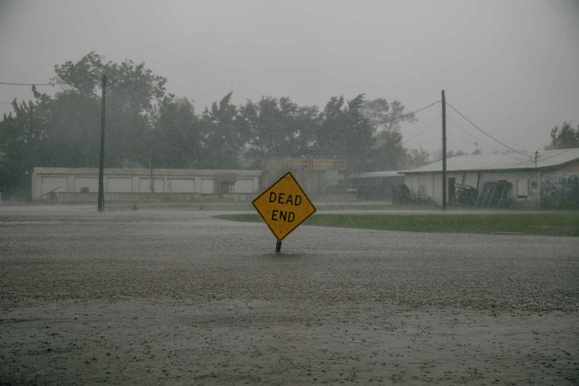 Floodwaters as Hurricane Delta made landfall in Delcambre, Louisiana, in October 2020. The storm was part of a record-setting year of cyclones. Photographer: Bryan Tarnowski/Bloomberg While people have gazed at the sea for centuries looking for signs of stormy weather on the horizon, it was only in 1984 that the first scientific attempt was made to predict the Atlantic hurricane season. The late scientist Bill Gray and his students at Colorado State University believed they could tease a signal out of water temperatures, weather patterns and teleconnections with weather patterns in other parts of the world to produce a forecast of how many storms would form in the Atlantic from June through November. In that first forecast, Gray and his team called for 10 named storms with seven becoming hurricanes. The season produced 11 storms and four hurricanes, showing that prediction was indeed possible. That opened the gates for others. AccuWeather jumped in during the early 1990s and the US National Oceanic and Atmospheric Administration rolled its forecast out in 1998. All those forecasts showed up at a key period for both society and the markets. Hurricane Andrew in 1992 reminded the public of storms' destructive potential, causing nearly $60 billion in inflation-adjusted damages and taking the title of the most expensive disaster in US history. (It's since been surpassed by even worse storms, from Sandy to Maria.) Having a sense of whether a season was shaping up to be particularly active or churn out more major hurricanes — that is, ones with winds above 111 mph (179 kph) — provided helpful planning information to people living in hurricane-prone regions and governments. As the new century dawned, offshore drilling accounted for about 25% of oil and 20% of natural gas production in the US. That made anything that provided clues about what might happen in the Gulf of Mexico a key piece of market intelligence. In recent decades, the number of Atlantic storms has been rising. This is partly because detection is much better than it was, but also because climate change is helping drive ocean temperatures higher. The world's seas are currently experiencing its second-longest record heat streak, and this hot water can turn a mild storm into a town-flattening monster. Sometimes it happens in a few hours, a process known as rapid intensification. That's been happening more frequently, particularly as storms near the coasts, which is exactly when you don't want a hurricane picking up steam. Even worse, our warmer world means the air can hold more moisture — and that more of that moisture can fall as rain. So storms that make landfall have increasing potential to leave a deadly path of misery, and even mild tropical storms now come with a higher risk of severe flooding. I've written about hurricanes, cyclones and typhoons regularly since 2008, but one of my first outings as a full-time reporter was 1985's Hurricane Gloria. My years are dominated by the storms. I hate them: Even small ones bring pain and misery. When storms are placed on forecast maps, I look at the tracks and calculate the casualties in my head. While the Atlantic is currently quiet and there's only one tropical storm spinning harmlessly through the North Pacific right now, I take no solace in that. All indications are that 2024 could be a terrible year. To stay up-to-date on hurricane season as it unfolds, please subscribe. | 








No comments:
Post a Comment