| Wroclaw doesn't have a metro, but its extensive bus and tram network places the Polish city near the top of the Atlas of Sustainable City Transport. The first-of-its-kind interactive map tool, which gauges the sustainability and inclusivity of transportation systems in more than 1,000 global cities, ranks Wroclaw second for best resident proximity to frequent transit — behind Prague and ahead of places like London and New York City. 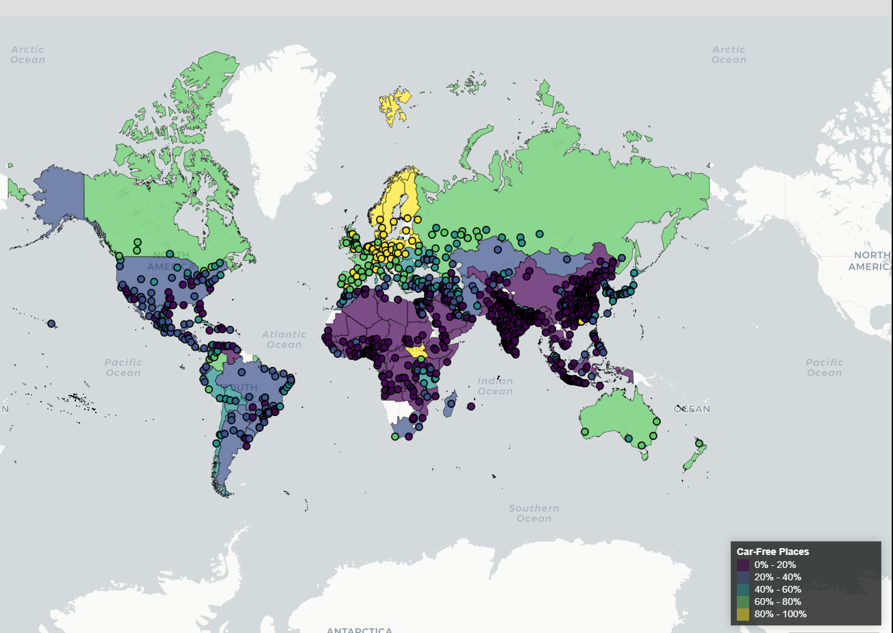 A screenshot of the Atlas of Sustainable City Transport's map of proximity to car-free streets. The new tool also scores metro areas based on measures like accessibility to car-free places and protected bike lanes. The researchers behind the atlas say that it can be used to set goals, generate ideas and measure progress for policymakers, planners and citizens. Read more from Fola Akinnibi today on CityLab: Atlas Shows How Sustainable Transit Is Around the World — Curtis Heinzl | 


No comments:
Post a Comment